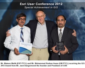
 In another landmark achievement, Pakistan Telecommunication Company Limited (PTCL) has been honored by U.S.-based Environment Systems Research Institute (ESRI) with the “ESRI Special Achievement in GIS Awards 2012” for outstanding achievements and organizational performance in geographic information systems (GIS) and programs.
The award was presented at the annual ‘ESRI Special Achievement in GIS Awards’ ceremony held at
San Diego, California, United States. PTCL’s Executive Vice President (EVP) Operations and Maintenance, Mateen Malik and General Manager Access Network Roshan Awan received the award from chief guest ESRI President Jack Dangermond. The award recognizes advances in geographic information system (GIS) technology to improve our world—and set new precedents throughout the GIS community.
Etisalat group played vital role in the success of the project by not only providing the expertise and sharing their experiences but also helping in the project till completion phase. LMKT Pvt. Ltd. helped PTCL in expertly deploying GIS for purposes of access network planning and asset management. The project scope also included Base-map development, Access Network development in Telcordia’s NE platform, Integration with other OSS / BSS enterprise systems (this integration became the differentiating factor for securing the award) creating a geographical common operating picture
“PTCL’s GIS program stood out amongst more than 100,000 others worldwide programs for its outstanding use of GIS technology in the existing network,” said Founder & President ESRI, Jack Dangermond on the occasion. “We have selected PTCL for this year’s award on the basis of its innovative applications of GIS technology in Pakistan.”
PTCL collaborated with LMKT in expertly deploying GIS in Islamabad region based on ESRI’s ArcGIS platform with telecom intelligence supplemented through Telcordia’s NE software for access network planning and asset management. The project scope also included Base-map development, Access Network development in Network Engineer (GIS), Integration with other enterprise systems (Fault Management, Billing and Customer Care, NOC, ERP), Configuring tools for GIS based copper/fiber optic network planning and network asset management and PTCL capacity building.
“This is yet another global recognition of PTCL’s technological edge and prowess in innovative solution integrations,” said PTCL President & CEO, Walid Irshaid. “My heartiest congratulations go to all PTCL employees for their hard work and commitment, which continue to bring accolades for our company.”
“We are extremely pleased how the project has turned out to be a GIS success story”, Chief Technical Officer (CTO) PTCL Muhammad Nasarullah. “GIS has become an instrumental part of PTCL in a very short period helping PTCL explore new avenues”.
“We are extremely pleased how the project has turned out to be a GIS success story. In this short period of just over a year from its completion, GIS has become an instrumental part of PTCL; from waiter clearance to Network Planning especially GPON, GIS is helping PTCL explore new avenues,” said Haroon Sharif, GM Technology Consulting LMKT on the occasion.
The U.S based ESRI is the world’s largest GIS organization with more than 350,000 affiliates and more than one million users. It is the only global company with a GIS portfolio covering all sectors of life starting from health to telecommunications. It is estimated that more than 70{e1f18614b95d3cd6e4b3128e1cd15d99b042a60a5a19c19b7a8e07e7495efa10} GIS users worldwide deploy ESRI products in one form or other.
PTCL’s achievement was once again able to put Pakistan’s name on technology forefront and bring honor for the nation.
May 19, 2025


