
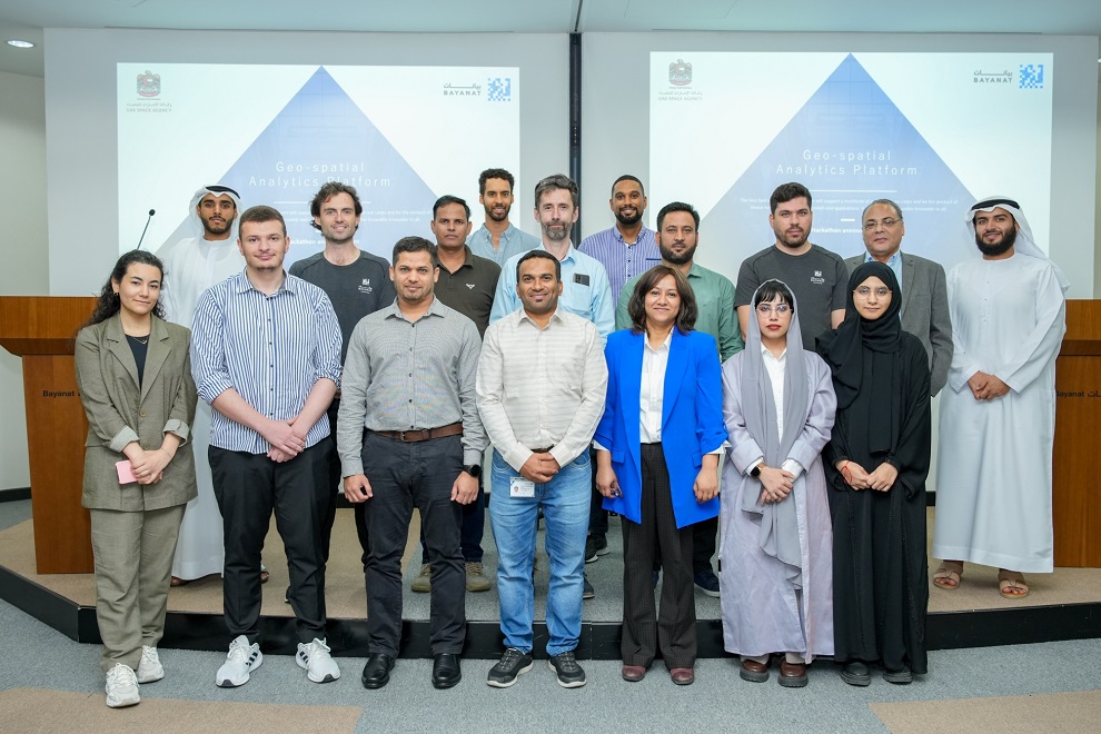
The UAE Space Agency announced the launch of the second round of the Geospatial Analytics Platform Hackathon at Bayanat headquarters in Abu Dhabi, building on the success of the first round’s participation and submitted proposals. The Hackathon, which will be held from 20 to 22 June 2023, focuses on analyzing the land-use changes in the UAE.
The Geospatial Analytics Platform Hackathon aims to have an early engagement with the developers and entrepreneurs to promote the offered capabilities that could be used to develop solutions for national and global challenges through space applications. Also, it is a great opportunity to participate in developing an Emirati-based technology for earth observation downstream applications.
HE Salem Butti Salem Al Qubaisi, Director General of the UAE Space Agency, said: “The selected theme for the Hackathon is Land use change in the UAE because land-use changes are the cornerstone of achieving comprehensive sustainability, shaping our future, and transforming our current challenges into opportunities that contribute to preserving biodiversity and adapting to the threats of climate change.”
HE Al Qubaisi added: “We strongly believe that joint efforts between the public and private sectors will certainly contribute to finding innovative solutions to such challenges at the national and global levels. Therefore, let us cooperate to understand land-use changes in the past, and be inspired by them to develop sustainable strategies. These strategies will enable us to face future challenges through the Geospatial Analytics Platform, where participants can exchange ideas and develop robust solutions.”
Mohsen Al Awadhi, Director of Space Missions Department, said: “The first edition of the Geospatial Analytics Platform Hackathon witnessed wide participation and competition among the best creative minds. Participants presented unique projects that aim to combat climate change and exceeded our expectations with their innovative analytics reports.”
Sultan Mohammed Al Zeidi, Space Projects Development Senior Engineer, said: “The Geospatial Analytics Platform Hackathon is one of the most prominent initiatives that will provide a digital framework enriched with machine learning techniques, and Artificial Intelligence (AI) to analyze space data quickly and accurately. Through the hackathon, we will measure the efficiency and effectiveness of developing innovative applications using the Geospatial Analytics Platform.”
Due to its success, more than 50 participants showed an interest in joining the hackathon. . Based on the received proposals after the first round of the hackathon, 5 proposals were selected out of a total of 9 proposals. Participants ranged between beginner, intermediate, and advanced levels.
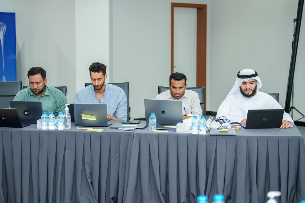
The second round, which lasted for three days, included mentorship sessions and workshops conducted by a talented team of five mentors from Bayanat. Following which, the teams were allowed to implement their ideas on the Geospatial Analytics Platform, leveraging cloud computing resources and the giQ environment for uploading their results.
The first day in the second round focused on introducing the Geospatial Analytics Platform Hackathon and its rules and highlighting a set of data and tools. The mentors also helped the teams prepare their computers and connect them to servers to obtain data. The orientation session focused on objectivity, methodology, and working on projects and proposals. The teams worked on proposals and projects with their mentors on the second and third days, held their final presentations, and attended the closing statements.
Land-use changes refers to changes that occur in land-use over time. This may include changes in agricultural activities, urban development, and shifting from the use of agricultural lands to other uses such as industrial, commercial, or residential. The Geospatial Analytics Platform Hackathon will delve into various aspects of land use, including but not limited to changes in vegetation, repurposing agricultural lands for housing or industry, converting urban and industrial areas into agricultural zones, and vice versa.
The Geospatial Analytics Platform is part of our vision to support sustainability efforts and achieve balance between economic, social, and environmental needs, in addition to enhancing agricultural productivity and mitigating negative environmental impacts, to deal with future climate challenges.
The Hackathon will culminate in announcing the two winning teams, in the first week of July 2023, who will be bestowed with a remarkable opportunity to continue working in the analytics report for showing-case their results during COP28 which will be hosted at Dubai Expo City in November and December 2023.
The first round of the Geospatial Analytics Platform Hackathon was launched on the 1st of June, on the sidelines of the ‘Make it in the Emirates’ forum, at the Abu Dhabi Energy Centre. It was attended by many companies, individuals, entrepreneurs, stakeholders, space technology experts and programmers in the field of Earth observation applications.